How to Use The Sunset
To use The Sunset, you’ll:
- Select a location (through using your current location, searching for a location, or manually placing a pin).
- Use the slider to find your chosen alignment.
- Look for the dates/times the sun will align!
A brief tour of The Sunset’s features:
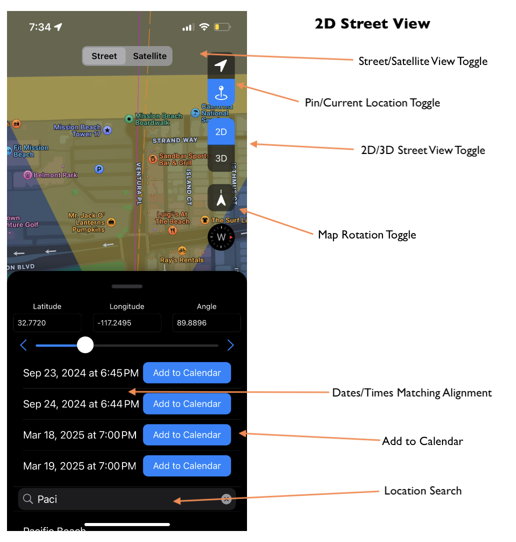
Map Views
The Sunset has 3 different map views:
- 2D Street View
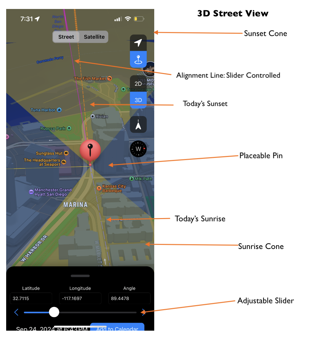
- 3D Street View (can be used to spot buildings or other structures to align the sun with or between)
- Satellite View
Sunset and Sunrise Lines
- Sunset cone: west facing cone with a dashed orange line that shows the full range of possible sunset alignments. Today’s sunset is indicated by an orange dotted line.
- Sunrise cone: east facing cone with a dashed pale purple line that shows the full range of possible sunrise alignments. Today’s sunrise is indicated by a dashed pale purple line.
- Alignment Line: a purple solid line controlled by the slider.
Toggles and Controls
- Angle slider: adjust the angle of the alignment line.
- Date/Time Output: shows days/times where the sun will be aligned with the angle.
- Street/Satellite View Toggle: switch map mode between street and satellite view.
- 2D/3D Street View Toggle: switch map mode between 2D and 3D street view.
- Pin/Current Location Toggle: switch between using a set pin and the user’s current location.
- Map Rotation Toggle: turn on to use phone orientation to examine map/align with sunset angle (to make sure you’re looking in the correct direction).
- Location Search: search bar to find any location and evaluate sunset/sunrise alignments.
Add to Calendar
Once you find your perfect alignment, click the “Add to Calendar” button to create an event (and reminder) for your upcoming sunrise or sunset event!